
West Lafayette ZIP Coverage
Indiana's Department of Workforce Development lists three ZIP codes for West Lafayette. That official city list establishes which numbers belong in a West Lafayette ZIP code directory, but it does not draw street-level boundaries. Only one inspected USPS facility record supplies a local retail-office address. The other two ZIPs need address-by-address verification, especially where Purdue or other institutional routing may be involved.
| ZIP | Verified area | Postal facility or route | Search caution |
|---|---|---|---|
| 47906 | West Lafayette, Indiana | West Lafayette Post Office, 610 W. Navajo St. | A facility point does not define the whole ZIP boundary. |
| 47907 | West Lafayette, Indiana | No separate current retail facility confirmed in the research | Verify each address through USPS; do not assume campus or unique routing. |
| 47996 | West Lafayette, Indiana | No separate current retail facility confirmed in the research | Do not infer PO-box, unique, or city-limit coverage from the number alone. |
The West Lafayette Post Office record gives the 47906 facility phone as 765-448-9288. It confirms the office location, not every delivery route. The official state list also separates Lafayette ZIPs, including 47901 through 47905 and 47909, which is a useful warning against treating a mailing city as a municipal boundary.
Verify a West Lafayette ZIP
The safest first step is the USPS ZIP Code Lookup. It offers an address mode and a city-and-state mode. The address mode is the stronger choice for resident research because it can return the deliverable ZIP and ZIP+4 for one full street address. USPS also warns that a successful postal result does not confirm that any named person or business occupies the address.
| Lookup mode | Input | Useful output | What it cannot prove |
|---|---|---|---|
| By address | Street, city, state | Current ZIP and ZIP+4 | Who lives or works there |
| By city and state | West Lafayette, Indiana | ZIP list for the place label | Exact street coverage |
The USPS screen used for this West Lafayette ZIP code directory is shown below. Its two modes make the difference between broad city routing and a precise address clear.
Open the official USPS ZIP lookup before copying a postal code into another public-record search.
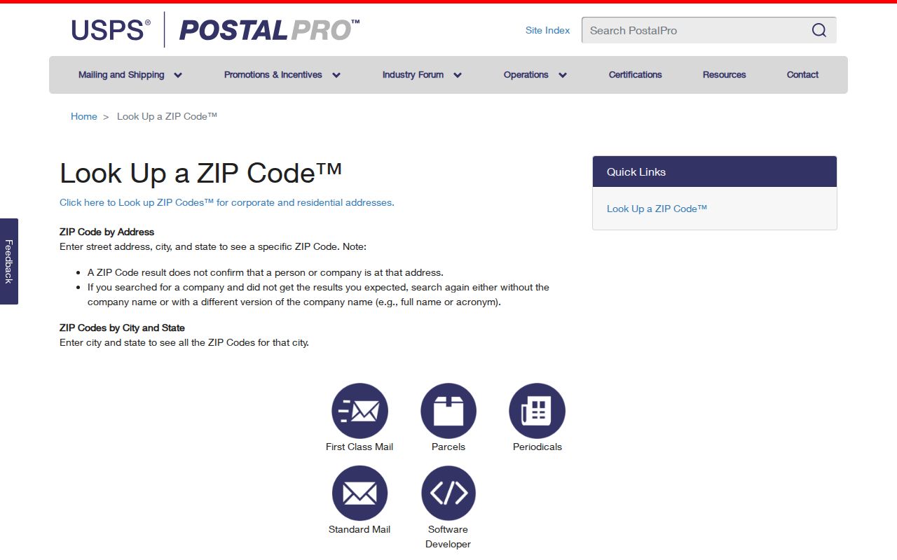
The captured form is a verification tool. A returned ZIP should next be tested against the county map and parcel record rather than treated as resident evidence.
Find West Lafayette Residents by ZIP
No official portal found in the research offers a complete resident list by ZIP code. The practical workflow narrows geography in stages. County GIS supplies the ZIP polygon and parcel context, while the property systems accept an address, owner name, or parcel identifier. The voter portal is designed to confirm one named registration, not to expose everyone inside a postal zone.
- Validate the complete address in the USPS tool and save the exact city, ZIP, and ZIP+4 returned.
- Search that address in the Tippecanoe County General Viewer. Turn on ZIP, incorporated-city, township, parcel, road, and precinct layers.
- Open the parcel popup and follow its Beacon link when available. Keep the property situs address separate from the owner's mailing address.
- Use the Treasurer search or Beacon with the exact address, name, or parcel number. Neither source was confirmed to provide a public ZIP-wide resident query.
- Once the postal zone has narrowed the area, continue with the West Lafayette street directory process for a named street or parcel.
This sequence moves from a broad postal label to a mapped parcel. It avoids false matches caused by mailing addresses that point elsewhere or by old records that use Lafayette, Chauncey, or an abbreviated West Lafayette label.
If the map and postal result disagree, preserve both rather than selecting the more convenient label. Save the USPS output date, parcel number, GIS layer date, and property-record link. Then call the Assessor or GIS staff for the mapped-jurisdiction question. A narrow written APRA request can seek an existing city or county address map, but the agency does not have to create a custom list of people inside the ZIP.
West Lafayette ZIP Search Fields
ZIP support varies sharply across official systems. The county GIS displays ZIP geography as a layer, yet its captured search menu did not show a direct ZIP-wide query. Beacon advertises owner, address, and parcel searching, while the Treasurer form uses district, parcel, name, tax year, or property address. Indiana Voters requires identity fields for a named person. Only the state licensing search clearly exposes a ZIP field.
| Official source | ZIP input | Better search key | Result scope |
|---|---|---|---|
| County GIS | ZIP map layer; direct filter unconfirmed | Address or parcel | Geometry and map context |
| Beacon | Live ZIP filter unconfirmed | Owner, address, parcel | Property record |
| County Treasurer | No ZIP field | District, parcel, name, year, address | Tax-roll match |
| Indiana Voters | No public ZIP search | Name, birth date, county | Named voter confirmation |
| MyLicense | ZIP text field | Profession, license, name, city, county, status | License affiliation, not a resident roll |
Use each source for the fact it actually keeps. A license location can support a professional-record question, but it is not proof of a home address. Likewise, a parcel owner may receive mail somewhere other than the parcel's situs address.
MyLicense Filters West Lafayette ZIPs
The Indiana Professional Licensing Agency verification search is the clearest official portal in the research with a ZIP text box. It can combine ZIP with profession, license number, name, city, county, status, or a business name. That makes it useful when the question concerns a licensed professional or registered practice in 47906, 47907, or 47996.
The captured MyLicense screen shows the ZIP field in context with the other filters.
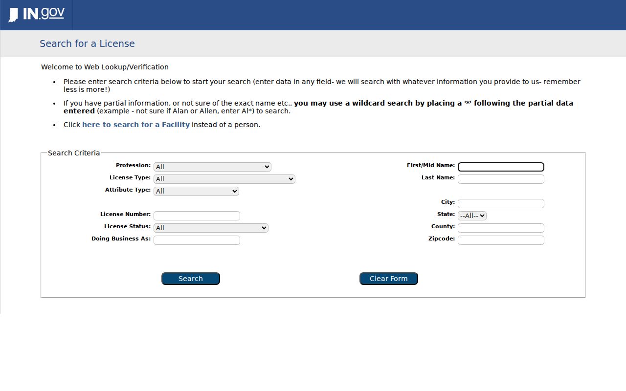
A returned record describes a license and its stated affiliation or location. Confirm the status on the official result and do not recast it as a household directory entry.
West Lafayette ZIP and City Lines
A ZIP code is a mail-routing device, not a city boundary. West Lafayette lies mainly in Wabash Township, with a small part in Tippecanoe Township, and the county map also carries city, precinct, subdivision, and zoning layers. Purdue's 2014 annexation into the city is another reason that an older civic label may differ from a current mailing result.
- ZIP code
- A five-digit Postal Service routing area. Its name does not prove municipal jurisdiction.
- ZIP+4
- The added four digits that narrow delivery to a smaller route, block, building, or group of boxes.
- PO-box ZIP
- A ZIP used for post-office boxes. The research did not establish that 47907 or 47996 has this status.
- Unique ZIP
- A code assigned to a high-volume organization. Do not label a West Lafayette ZIP unique without USPS confirmation.
- Carrier route
- A delivery path within a ZIP. It is not the same as a neighborhood, precinct, or parcel boundary.
Old West Lafayette ZIP Clues
Current ZIP codes should not be forced onto records created before modern routing. West Lafayette grew from Chauncey, Oakwood, and Kingston, which merged in 1866; the West Lafayette name arrived in 1888. Older directories and maps can therefore list Chauncey, Lafayette, W. Lafayette, or a combined Lafayette and West Lafayette entry for a place now reached through one of the three current ZIPs.
For a historic address, retain the modern parcel and legal description, then search old directories under each relevant place label. County maps from 1866, later Lafayette and Chauncey maps, Sanborn sheets, and directory page images can bridge a changed label. This local quirk matters more than guessing which present ZIP would have covered an old household.
Note: No official chronology of every West Lafayette street renaming or renumbering was found, so confirm changes through maps, plats, and city records.
What ZIP Records Prove
A West Lafayette ZIP code directory organizes geography, not people. USPS can verify deliverability. GIS can place an address inside a map layer. Beacon and the Treasurer can tie a property record to an owner or mailing address. Each fact has a different custodian and date.
Do not turn a ZIP match into a claim that a person resides there. Household members may not own the parcel, protected voter data may be withheld, and commercial compiled results may merge old addresses. For map questions, call the county GIS or Assessor; for postal routing, use USPS at 1-800-ASK-USPS; for historic addresses, ask WLPL, TCPL, or the Tippecanoe County Historical Association.
The same care applies to statistics. The city planning figure of 45,595 residents in the 2020 Census and the official estimate of roughly 7.6 square miles describe West Lafayette as a whole. They are not counts for 47906, 47907, or 47996. Purdue's large institutional presence also makes citywide totals a poor shortcut for the number of people attached to any one postal route. Use a dated source that explicitly publishes a ZIP-level measure before making a per-ZIP comparison.
When an online search remains unclear, use the documented fallback channels. County GIS, the Assessor, Treasurer, Recorder, Election Board, and city planning staff can answer questions within their own record areas. The libraries and historical society can compare old directory labels and maps. Ask by phone, counter, mail, or a narrow records request, and include the exact address and date range. This turns the West Lafayette ZIP code directory into a routing tool while leaving every factual claim with the office qualified to verify it.